Environment Canada lifted the freezing drizzle advisory for Ottawa just after 11 a.m. Sunday morning. The yellow-level warning had cautioned residents about icy conditions and light ice accumulation across the region. After several hours of careful monitoring, meteorologists determined conditions had improved enough to cancel the alert.
The weekend brought challenging weather to the nation’s capital. Saturday saw Environment Canada issue a special weather statement warning of heavy snow and freezing rain overnight. Many Ottawa residents woke Sunday to slick sidewalks and icy road conditions that made morning commutes treacherous.
I’ve covered weather events in Ottawa for years now, and these transition periods always catch people off guard. One morning you’re scraping ice off your windshield, and by afternoon you’re dodging puddles in milder temperatures. It’s the kind of unpredictability that defines winter in Eastern Ontario.
The special weather statement was lifted shortly before the freezing drizzle advisory took effect. This progression shows how quickly conditions can shift in our region. Environment Canada’s Ottawa weather office works around the clock during these events to provide timely updates to residents.
Light ice build-up was the primary concern during Sunday morning’s advisory period. Freezing drizzle creates particularly hazardous conditions because the ice forms immediately upon contact with cold surfaces. Roads, sidewalks, and vehicle windshields become slippery within minutes.
Ottawa Public Works crews were out early Sunday addressing problem areas. The city’s winter maintenance teams monitor weather advisories closely and deploy salt trucks and sanders as needed. Their quick response helps minimize accidents and keeps major routes passable during difficult conditions.
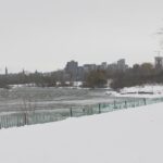
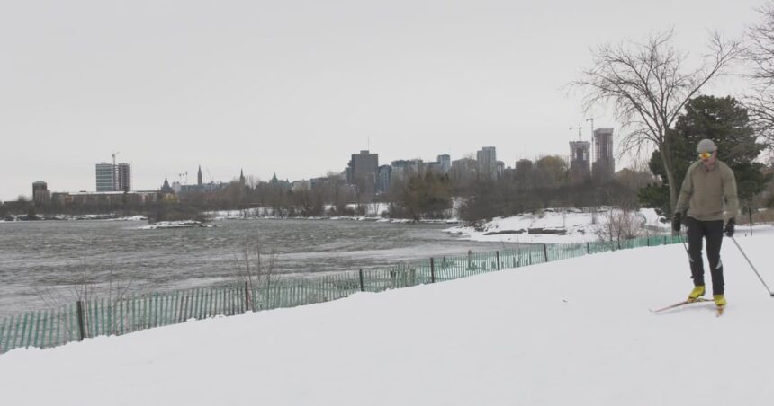
Sunday’s temperature reached a high of zero degrees Celsius. Cloudy conditions persisted through the evening hours as the system moved through. The overnight low was forecast to drop to minus six degrees, bringing clearer but colder conditions to the region.
The temperature swing reflects typical late winter weather patterns for Ottawa. We’re in that awkward season where morning frost gives way to afternoon thaw. It creates messy conditions but signals spring is gradually approaching.
Monday’s forecast calls for temperatures climbing to two degrees Celsius. Mostly clear skies should provide a welcome break after the weekend’s grey, drizzly conditions. Residents will likely see melting ice and snow as daytime temperatures hover above freezing.
Tuesday brings a mix of sun and clouds with temperatures again reaching two degrees. The three-day outlook suggests relatively stable conditions after Sunday’s advisory period. No significant precipitation is expected in the immediate forecast period.
Environment Canada issues advisories based on specific weather criteria and potential impact to public safety. Yellow advisories indicate conditions that could affect daily activities and require extra caution. They’re less severe than red-level warnings but still warrant attention from residents.
The weather agency’s Ottawa station serves the National Capital Region and surrounding communities. Meteorologists analyze data from weather stations, radar systems, and computer models to predict conditions. Their forecasts help residents plan activities and prepare for potentially dangerous weather.
Local emergency services remained on standby during Sunday’s advisory period. Ottawa Police, paramedics, and fire services see increased call volumes during winter weather events. Slip-and-fall injuries and minor traffic collisions typically spike when freezing drizzle creates icy surfaces.
Ottawa’s winter maintenance budget accounts for these unpredictable weather events. The city maintains stockpiles of road salt and employs hundreds of operators to manage winter roads. It’s a massive logistical operation that runs from November through April most years.
Residents are encouraged to check Environment Canada’s website regularly during winter months. The agency provides hourly forecasts and seven-day outlooks specific to the Ottawa area. Weather conditions can change rapidly, and staying informed helps people make safe decisions.
Sunday’s lifted advisory came as relief to many who had weekend plans. The timing allowed afternoon activities to proceed without major weather disruptions. By midday, conditions had improved enough that most outdoor plans could continue safely.
Ottawa’s weather remains notoriously difficult to predict with precision. The city sits at the confluence of different weather systems moving through the Great Lakes and St. Lawrence Valley. This geographic position creates highly variable conditions, especially during seasonal transitions.
The weekend’s weather event wasn’t particularly severe by Ottawa standards. We’ve experienced far worse freezing rain storms that left the city paralyzed for days. Sunday’s advisory represented more of a nuisance than a major crisis.
Still, even minor ice accumulation deserves respect. I’ve seen too many people end up in hospital emergency rooms because they underestimated slippery conditions. Taking simple precautions like wearing proper footwear and allowing extra travel time makes a significant difference.
Environment Canada meteorologists will continue monitoring conditions throughout the week. Any changes to the current forecast will be communicated through weather statements and advisories. The agency’s alert system ensures residents receive timely information about potentially hazardous weather.
As we move deeper into late winter, Ottawa residents can expect continued temperature fluctuations. These boom-and-bust cycles are normal for February and March in Eastern Ontario. Patience and preparedness remain the best strategies for navigating our unpredictable winter weather.